October, 2024
Back in 1919, long before the Deception Pass bridges were built in 1935, there was a small ferry boat that ran between Fidalgo Island (to the north) and then to Whidbey Island (to the south). That ferry had a schedule during the day, but it was also, amazingly, “on call” at night. The ferry was moored at a dock over on Fidalgo at night and the captain (Berte Olson) lived in a home right there too on Fidalgo Island. So, for an emergency at night when someone on Whidbey needed medical help, etc, then over there on Whidbey was a huge metal gong hanging in a tree next to the water, next to the ferry dock. If there was an emergency at night on Whidbey, then someone could use a hammer and bang on that gong. Over on Fidalgo Island, Berte Olson would be awakened by the gong reverberating across the water. She would get up, and would bring the ferry boat over to Whidbey and pick up the people who needed emergency services, that weren’t available on Whidbey in those days.
But then in 1935 or so, the two bridges were built across Deception Pass, and Berte Olson was put out of business. On my camping trip here in 2024, I wanted to see if there was any evidence of those two ferry boat docks on Fidalgo and on Whidbey.
First off, I drove to and walked out onto the Deception Pass bridge and looked east … Fidalgo is on the left, Whidbey is on the right. Somewhere out there, that small ferry boat crossed between the two islands, ferrying cars and people back and forth.

From the bridge, I then drove north onto Fidalgo Island and drove as close to the water as I could trying to find a sign indicating the old ferry dock location on Fidalgo, or even if I could find just a possible location for a road down to the water, and a beach that would have been amenable to a ferry dock and automobile traffic.
The photo below gives you some idea of how steep the land was there. That’s a driveway down to a home on the left. And below that driveway was a rock wall, no beach at all.

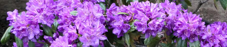
But I found this lovely tree in brilliant hues of autumn red and yellow. What is it? Help me here.


I drove further around on Fidalgo to the east where I could look back towards Deception Pass from the opposite direction of my view in the first photo above. Still nothing but solid rock around the water … no beaches or gentle incline that would lend itself to a ferry dock and access by automobile.

So I drove back to Whidbey and drove east to Cornet Bay, and then drove as close as I could to that very northern-most point of Whidbey, Hoypus Point. That road along Cornet Bay ends at the Deception Pass State Park marina and the Hoypus Point Natural Forest Area. One source of info for the old ferry that I’d read mentioned Hoypus Point. So I parked, walked past the gate (perfectly ok to do), and headed out on foot hoping to find Hoypus Point.


Every once in a while, I would stop and walk through the trees on the left and look out over the water of Deception Pass to see what I could see. Well THIS view below was spectacular! Both of the bridges in view with Pass Island in the middle connecting them.

And I would often stop and look north over at Fidalgo Island, but there were only rock walls edging the water and steep terrain. Where could that ferry dock have been?

So on I walked (it was a long trail). In the photo below, I was tempted for a moment to take the trail uphill to the right … it was obviously the more used trail. But I figured the ferry dock would not be uphill. It would be right down at water’s edge, so onward I went on the level path right in front of me.


I realized that the ferry here ran from about 1919 to about 1934, so today (in 2024) there might be absolutely no evidence of the ferry docks left on either the Fidalgo side or the Whidbey side.
Stopping for another brief look over at Fidalgo (below) gave me a little hope. There was a beach over there, and the land up from the water was not as steep. Still no evidence of an old ferry boat dock, but it gave me incentive to continue on along the trail on the Whidbey side.

And then I found it! The old ferry dock spot! There was no mention of it until I walked out onto the area in the photo below. In truth, I had passed Hoypus Point about five minutes prior to this spot, no evidence of a ferry dock there. But I kept going. This area in the photo below (the end of the trail) was just around the corner from Hoypus Point so this area was protected by Hoypus Point from wind and waves coming in from storms that came in through Deception Pass. Ah, a perfect location for a ferry boat dock!

Notice the large concrete structure out in the water, just off the beach, in the photo above … that’s important!
Below are closeups of the two informational panels here. In the first one below, notice the white seagulls on the lower right of that photo … and notice the concrete structure that’s holding up the ramp that leads from land then out to the ferry boat. THAT is the same concrete structure used back in 1919 that is still here today in 2024. Amazing.


In the photos below, I’m standing on Whidbey right where the ramp would have been that led out to the ferry boat dock … the ramp that was supported by that concrete structure. All other components of the ramp structure, the pilings, etc, were wood and have long since disappeared.


The photos below are looking east towards a few small islands and then the mainland of Washington State.


That was really an exciting find, a bit of history that I thought didn’t exist any more. It was also interesting because Captain Berte Olson was the first woman in Washington State to hold a Captain’s license and she was the skipper of that ferry, not her husband. She also maintained the ferry, engine and all. So this sure was fun for me. And yet I still wondered about the location of the ferry boat dock over on Fidalgo Island to the north. So I kept looking and looking, peering through my zoom lens on my camera.
Well, I think I might see something (in the photo below) … over on the beach, on the left side of the photo? Looks like maybe some old pilings? Click on the photo to enlarge it.

Yes indeed! Here’s a closeup below. Could that be where the ferry dock was on Fidalgo Island? Hmmm.

Well, I figured I might never know the answer to where the dock was on Fidalgo, but I was really happy having found the location on the Whidbey side. So I simply started walking back to where the big white truck was parked. With the tide mostly out, I chose to walk back on the beach. It was such a beautiful day. Ahead of me, I could see a very small rock out in the water a little bit off the beach and it looked like there was something moving on the rock.

Indeed! A Great Blue Heron standing almost perfectly still.

Except for THIS! I don’t know what prompted the heron to look up, but it was a fast and dramatic movement.

And in another second, its head was back down where it belonged and it didn’t look up again as I walked past it. In fact, it didn’t even look over at me although I was on the beach right at water’s edge and wasn’t more than ten feet away, probably less.

Eventually, the beach ended and steep rocks appeared between the water and the trees so I clambered back up through the trees and back onto the path that took me back to my pickup truck.

Later this same day I drove back over to Fidalgo Island after having figured out on a map where those specific homes were that had those old wood pilings in the water in front of them. I boldly knocked on the front door of one of those homes, and was greeted by a very friendly homeowner who told me that yes indeed that IS where the ferry boat dock used to be on the Fidalgo Island side. Wow, I found both ferry docks. 🙂
So if you’re a local here around Puget Sound and want to know where these places are, or if you’re simply curious how all this fits together, here’s a map below. RED circle on the left is my campsite. RED arrow on the left points into Deception Pass, that horrific (or lovely) passage of wind and water from the ocean. Fidalgo Island is to the north. Whidbey Island is to the south. The YELLOW arrow on Whidbey points to Hoypus Point. The two small WHITE arrows point to the ferry dock location on Fidalgo and to the ferry dock location on Whidbey. You can see that those ferry docks are protected from ocean wind/waves by Yokeko Point on Fidalgo and by Hoypus Point on Whidbey.

And THAT is your history and geography lesson for today. 🙂 No tests will be given, everyone gets an A+!
Wow, I’ve been through Deception Pass on my boat, twice (each direction) but I’d never heard about this history. This is great! How cool that you found both spots. Wish I still had my boat. 🙂
There is so much history in Puget Sound, isn’t there? Yep, sometimes I wish I still had my boat too, Mark.
Fantastic find! Good for you for wondering … and then searching (and researching). I don’t know anything about boats or Deception Pass but it was a thrill to see where the ferry dock was on Whidbey because you made it so interesting. Love the heron.
But … does one do “RE-searching” first, and then secondarily do the “search”? Shouldn’t one search first and then secondarily do “RE-searching”? Goofy language we have. 🙂
Ha! Good question about the words “searching” and “REsearching” … one might think that REsearching was a second set of searching AFTER the initial searching, just like you say, Lori. Goofy language indeed. 🙂
Feels like I ought to know what that tree is … long yellow five petals with red stems. But I can’t place it, and I can’t find it online. I loved the search for the ferry docks! And that you found them. I really love the very first photo you took from Deception Pass bridge … how beautiful. Here’s to Berte.
I felt like I should know that tree too, Pat, but I don’t, and I couldn’t find it online either. I bet someone else here will know and tell us. Nice comment. Thank you.
Escape Trailer now has yet another size/option for trailers! I can’t make up my mind. 🙂 But gosh when I do, I will explore and learn things like you do. This was a great story of reading, online research, boating knowledge, personal local land knowledge, and perseverance, and a brave knock on that homeowner’s door, to find those two ferry dock spots. Good job! 🙂
Yes, I heard that ETI is planning yet another trailer size. I hope you find just the perfect one for you, Emily. They are wonderful trailers. Thanks for you lovely comments. 🙂
What an impressive search/research. 🙂 Truly. I love the maps. Thank you, this was great. That weird heron photo was super. 🙂
Ha! You are welcome Ben. That was a weird heron thing wasn’t it. 🙂
That yellow leaf tree is a bit confusing, but I think it’s a Japanese Maple tree, where the leaves are red most of the year but then turn yellow with red points on the end of the leaves and red stems. But I’ve not seen one this dramatic, I love it! Love those heron photos too.
I’ll hang my hat on your idea about the tree, Ruby. You sure know plants! And yet, like you, I still can’t find photos that match the tree I saw. Wow, I’d love to have one in my front yard.
I’ve lived in the Seattle area most all of my life and never knew there were so many fascinating stories, real history, around Puget Sound. Great info and photos.
I started learning about the history around Puget Sound when I had my first boat, then my second boat … and now with the RV trailer, I’m learning even more that I never knew existed. It’s fascinating stuff about real people. Thanks Bill.
Fascinating. Here’s to Berte Olson! I need to spend a whole summer camping around Puget Sound.
You get over here Susan! Let me know when you’re coming and I’ll share info or maybe even we could meet up at a campsite, that would be cool. 🙂
Great photos. Really liked that concrete structure that it was still there more than a hundred years after it was built. This was great.
My reaction too, Greg. That concrete structure was more than 100 years old as I stood and looked at it, with all of the tides and storms, still it’s there. That was really cool.
You did it again! You found something I knew nothing about! I knew nothing about the ferry between the two islands. Fascinating! Great job findingthe two terminals. We have walked down the trail from Coronet Bay, but apparently we never made it that far. Of course it’s been several decades since we walked it and who knows if the signs were even there back then. Thank you for the education.
The picture from the bridge and the one of the bridge are both great shots. Also really like the ones of the great blue heron.
Another great blog post! 😃
Fritzi, you didn’t know about this?!? I’m amazed, you have shared so much with me about things I knew nothing about. Well, that pleases me that I can share some things back with you too then. 🙂
You find the best places and the best stories! I sure wish we were still camping and were following you around. I think other folks here have said that as well. It’s true, you should be a camp leader! 🙂 Lovely photos. Great maps.
Camp leader! Actually that would be fun. 🙂 Thanks Wanda, I’m glad you’re here.