October, 2024
No! I’m not saying that all of us are supposed to spit! We’ve talked about this before when I visited Dungeness Spit on the Olympic Peninsula here in Washington State. No spitting! 🙂
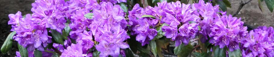
At the north end of Whidbey Island, over on the east side of the island, there is a spit of land called “Ala Spit”. That’s where we’re going today. I’ve been past that spit of land many times in my boats, but I’ve never driven there on the road. Today … we go by road! 🙂
Here’s a map below of just the very north end of Whidbey Island. The RED dot on the left is where I’m camped. The YELLOW arrow points to the Deception Pass Bridge (where ocean water races back and forth with the tide from left to right (and then right to left). The RED arrow on the right points to the northern tip of Ala Spit. Notice, also, there’s an island next to Ala Spit … Hope Island (north). [There is another Hope Island in south Puget Sound … hence the words “(north)” and “(south)” have been appended to their names to reduce confusion.]

As you can see, I didn’t have far to drive from my campsite in order to reach Ala Spit. It was just a short, lovely, autumn country drive.

The small green sign in the photo above states that Ala Spit Beach Park is maintained by the local Oak Harbor High School Honor Society. Oak Harbor is the largest town on the island and is just a bit south of this location. I went to high school there … there was no national honor society when I went there, just sayin’. 🙂 Maybe that’s a good thing, or I would have been one of the volunteers who maintained this Park. On the other hand, I bet I would have loved doing that.
So, I drove down a short access road, parked, and then walked out onto the southern part of the spit, and I turned and looked north. Wow, what a beautiful view! The small, protected bay to the left of the spit, between the spit and the big island (Whidbey), was so beautiful and calm. (Please enlarge this photo if you can, it’s a gorgeous view.)

The spit itself (it’s just shy of half a mile long) was chock-a-block full of old tree trunks and tree limbs washed up there by the tide and storms. There were sections of the spit where you either waded in the water to get around the tree debris, or you waited for the tide to go out a bit so you would have beach access to the next section.


I’m not sure whether that’s a tree trunk in the photos above and below, or whether it’s a VERY dangerous human-eating animal. I didn’t wait around to see if it would suddenly curl around towards me and open its mouth to snap off one of my feet or one of my legs. Yikes.

Here below are two videos I took while I was standing on the very southern shore of that little bay between Whidbey (on the left) and the spit. It was high tide. Turn your sound on and listen for geese.
And then, below, still standing on the southern part of the spit, I turned to face east, towards Hope Island. It looks like there’s lots of water between Ala Spit and Hope Island, doesn’t it? Ahh, looks can be deceiving!

And then I turned to look south (below). The small islands in the photos below run along a human-dredged channel that becomes the Swinomish Channel off to the left that takes boaters to the town of La Conner (and then further north after that).

You can see a boat in the distance on the very right edge of the photo (below). It had come south between Hope Island and the spit and was now heading further south towards large Camano Island, Everett, Edmonds, Seattle … who knows where they were headed? But look at that large tree trunk in the water. It was not floating, it was sitting solidly on the bottom. It is REALLY shallow here, on the east side of the spit, the side that faces Hope Island. In a boat, you don’t want to get any where near this spit or you will run aground.

To polish that point, I waited until late in the afternoon this same day and then drove back here … at almost low tide. The tide was not quite all the way out yet, but getting close to it. The photo below shows how that lovely, peaceful small bay looks at low tide. It’s mud!

Then below, looking at the west side of the spit, again that small bay … all mud.

And now (below) take a look at the east side of the spit, the side towards Hope Island. If you look closely, you can see some of the tree trunks up on the spit on the very left side of the photo below. The distance between those tree trunks up on the spit and the edge of Hope Island is about .3 miles.
Once the tide is all the out, low, there’s still a LONG expanse of mud that’s just a few feet under the water. That expanse of mud/sand extends more than half way over to Hope Island. You don’t want to run your boat any where near the spit! You want to be WAY over and right next to Hope Island. In fact, I’ve been by here in both of my boats over the years. One time, when I was heading north, I pulled over to Hope Island, slowed WAY down, watched my depth-sounder to make sure I had plenty of water under my boat. I pulled up right next to that rocky point on Hope Island, reached my hand out my boat’s window, and touched the rock! All with plenty of water under my boat. So you really do want to be way over next to Hope Island and no where near Ala Spit.

Here below is a video I took this morning, at high tide, of a boat heading north between Hope Island and Ala Spit. You’ll see that it is way over next to Hope Island, nicely done.
I sure enjoyed seeing a part of this world that I’d seen many times by boat, but never from a land perspective. What a beautiful and fascinating world we live in, yes?
Safe travels everyone, keep your eye on the depth-sounding equipment in your boat, and watch those tide charts too. 🙂