July-August, 2019
It’s a beautiful morning! Let’s take a walk to the Lewis River. 🙂
In truth, it’s actually called the East Fork of the Lewis River, but I suspect the river itself doesn’t really care what we call it.
The road from the campground to the river starts inside the campground and ends right at the water’s edge on the East Fork of the Lewis River. There are no other paved roads off of this road, no homes along the road, and no other access, so there is almost no traffic on the road. It’s just a nice little road that’s about a mile long, and downhill at that (although I swear it’s about FIVE miles walking back to the campground since it’s all uphill all the way in that direction).

What a lovely, peaceful morning walk. The birds were singing, a sweet summer breeze was rustling the leaves, tiny little critters were nuzzling around in the underbrush.
The place felt so rich and luscious.

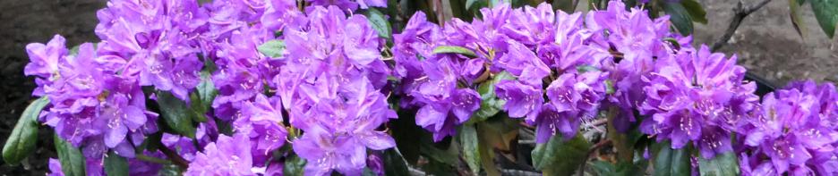
Of course, I came upon a large wild animal who eyed me warily … a Giant Moss-Backed Anteater (photo below).

But she wasn’t dangerous, so I snapped her photo and kept on walking down the road.

All kidding aside, the moss was exceptionally thick and so very vibrantly green.


The blackberries couldn’t decide whether they were still green and tart, or black and sweet and ripe for eating, or somewhere in between.
Eventually, I could see the river through the trees, down to my right. I hadn’t realized how far down the river was … or maybe how far UP the campground was. I hadn’t realized there was so much difference in elevation. But as mentioned, on my walk back UP to the campground I certainly noticed it then.

I started to hear the river too. At this point on its journey, the river was placid and relatively quiet but still had a bit of a voice.
I bypassed a gravel roadway that led to the river’s edge and instead walked on along the paved road to its very end, wanting to see it all … aargh, wish I hadn’t! That dang freeway was there!

The paved road went under the freeway, then ended at river’s edge. There was a large parking lot on the other side of the freeway. There was also a park there with picnic tables and such, and a frisbee golf course, and opportunity for small boat launching and fishing in the river. But the noise!

I did find it a tad bit interesting to see the difference in construction of the northbound freeway lanes (on the right above) and the southbound freeway lanes (on the left above). Seems the northbound bridge is quite a bit older.
That took me about 30 seconds to see, and then I got out of there … away from the freeway and back to that much quieter gravel road access to the river!
Ah, yes, the lovely, quiet, meandering river. 🙂

While I was here, there wasn’t another human being about … just me and a warm breeze and the river. I walked and sat … and sat and walked. I poked around in the mud and the bushes and listened to the birds.

These nice descriptive signs were near the river (click to enlarge) ….


The Lewis River empties into the mighty Columbia River about four miles down-river from where I was and where these signs were. At that point, four miles away, where the Lewis empties into the Columbia, the mighty Columbia is still about 80 miles from the Pacific Ocean. And yet, even at that distance, the flow of the river water and the height of the river water is affected by the wind and tide coming in from the Pacific Ocean. The Columbia River isn’t salty this far upriver, but when the tide is high out at the coast, then the Columbia River will back up into itself and, in turn, rivers like the Lewis River will also back up into themselves, the fresh river water being prevented from flowing downstream due to the height of the ocean saltwater tide. The Columbia River is the fourth largest river in the USA (after the Mississippi, Ohio, and Saint Lawrence Rivers), and yet it can be held in abeyance and must fight to empty its waters into the Pacific Ocean. As many years as I’ve lived in the Pacific Northwest, I didn’t realize that rivers could flow backwards 84 miles upriver (or even further) from the Pacific Ocean.
There’s always something to learn, eh? 🙂
And there’s always a quiet, peaceful part of the river to be found.


What a wonderful way to start my first full day of camping at Paradise Point State Park. Paradise indeed.
This all looks wonderful. I can see why you’d want to explore there.
🙂
I didn’t know the ocean held back rivers! That’s what I get for living in Montana all my life I guess, hey Ann? I sure like how you educate us. And how you find the best spots to camp. Can’t wait to hear more. (smile)
More is coming soon Tim. Thank you for being here. 🙂
A friend of mine took me drift fishing on the lower Fraser (the tidal Fraser) here in Canada some years ago. The tide was coming in and the wind was from the west. I’d heard about the river running backwards but never experienced it until then. The current took us UP-river, not down. Along the banks of the river it wasn’t so bad, but in the centre of the river that current was moving fast, up hill!
I bet that was a weird feeling … to have the current pushing you uphill as it were. I hear that Canadians are the best fisher-people. 🙂
You have learned and experienced so much on these little outings! They are charming.
Thanks Kristin. 🙂 I’m sure having a great time!