October, 2020
My camping friends headed home this morning. But I’m staying right here! I have all day today and then tomorrow, too, to see if the weather will clear enough so that I can see into the crater of Mount St. Helens.
I wished my friends a safe trip home. Off they went on their journey, towing their handsome Escape travel trailer behind them.
And then I jumped in my big white truck and headed up the road towards Mt. St. Helens. After our very cloudy drive up there yesterday, today will be my second trip up to the mountain/volcano.
Let me tell you right off that today I do see more of the crater than my friends and I saw yesterday. I’ll share photos below. In fact, today I could see some of the lava dome that is again building in the center of the crater, though there were still clouds covering the topmost part of the mountain. I’ll tell you more and show you more but first, let’s get up the road to that mountain!
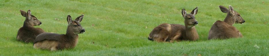
Blue skies and horses were my guides.

By and by, I arrived at Hoffstadt Creek Bridge (below) … that very long bridge, the tallest bridge in the State of Washington … that my friends and I stopped to visit yesterday. Look at that blue sky. Here’s hoping for a clear view of the mountain and the crater!

Oh, say, maybe I should explain just a tiny bit about “the crater”. Some of you may be wondering how anyone can see into a volcano’s crater without flying over it or without climbing all the way right up to the edge of the crater, and then leaning over the edge. Here’s the answer …

The photo on the left above is of the northern side of Mt. St. Helens before it erupted in 1980. The RED line is how much of the mountain was blown off by the eruption.
The photo on the right above is also of the northern side of Mt. St. Helens, but the photo was taken just a few years after it erupted. The volcano didn’t blow UP … it blew OUT, horizontally, laterally, it blew towards the north. In other words, if you were the photographer of the photos above, the volcano blew right at you. As a result, you can be standing on the shore of a lake that’s north of the mountain, a lake that’s lower than the crater, and yet you can see into the crater. By the way, the steam that is rising vertically in the photo on the right above is steam that’s coming from inside the volcano and up through the new lava dome that is building and that will erupt again one of these days.
There are excellent views into the crater of Mt. St. Helens from a number of spots along the road I was driving today … the view simply depends on whether fluffy white clouds are present.
Here’s to more blue sky! Let’s get on up this road!

Oops, just a few miles later … dark, ominous clouds appear. No matter, I’m still going!

Later on up the road, I pulled off at this overlook (above). Dark clouds still threatened, but off in the distance there was some blue sky. And yet a zoomed-in photo taken from this overlook proved that fluffy white clouds were in abundance all around Mt. St. Helens.

Another stop along the road (below) … blue sky! Yay! And fluffy white clouds, grrrr.

With all those clouds, I stopped being in a hurry to get up to the observation points closest to the mountain. Instead I took the time to look around me on my drive. All of the massive stands of dark green trees in these photos were planted by the Weyerhaeuser Company after the eruption (RE-planted since all of their trees that were already there had been destroyed by the eruption). They lease millions of acres of land from our government. They don’t plant trees on the lower, flat areas because those areas flood every spring with rain and snowmelt. As a result, we can still see many of the downed trees that had been blasted by the eruption 41 years ago. Most of the trees that were downed here have long since been covered by ash/mud that washes through the area every spring. But you can still see lots of the downed trees.

41 years ago, right after the eruption, you could practically walk across this valley, and even up the side hills, stepping from tree to tree, never touching the ground. You can probably search online and find photos from back then of the downed trees. Ok, let me go find one photo for you … here’s one. Remember, these were full-grown trees, twisted and broken off at the base in the first few seconds of the volcano blast, every tree was stripped of every branch and limb and every bit of green growth … millions of acres of trees looked just like this. The photo below is but one small portion.

And then on up the road I went. Eventually, I arrived at the Loowit Viewpoint, one of the prime viewing locations for the crater.


The photo above is of my truck’s dashboard. The Loowit Viewpoint is at 4,000 feet elevation. Up here, in October, it was cold! The truck’s dash readout proves the point … 37 degrees F (2.8 Celsius). I hadn’t realized it would be so cold here, but I always carry heavy gloves and extra jackets and a warm hat in the truck, so I was good to go. Thank goodness there was no wind here today.
When I arrived at Loowit, the mountain was swathed in fluffy white clouds, so I simply walked around, exploring the terrain, the plants, the ground.

I was surprised how many trees were still on the ground, and hadn’t decomposed, hadn’t rotted yet. And yet, I read that the eruption was so violent that it literally blasted hot ash and pumice INTO the wood of the trees in such microscopic pieces that the wood may never rot, the wood may never decay, at least not in our lifetimes.


Trees were smashed to smithereens. Maybe from other trees hitting them with such force, or maybe just from the blast of the volcano. Info on the internet says the speed of the gas/air, the speed of the hot ash/pumice … the speed of all of that “stuff” that was blasted from the top 1/3 of that mountain, the speed of that initial blast is estimated to have been 670mph. At 670mph, that blast traveled 11 miles in less than one minute. When I think about that, I wonder that there was anything left, any trees at all, those millions of trees broken and killed instantly, denuded of every inch of green, and smashed to the ground. It’s a wonder that the trunks of those trees weren’t blown to bits.
In fact, the Loowit Viewpoint is about 5.5 miles from the center of the crater. Should the volcano erupt again while I’m standing here, I’d have about 28 seconds to say my final prayers before the blast hits me. Isn’t life full of interesting and curious things? 🙂
Little Towhee was curious too. You can bet your boots that she was with me on this drive. She knows an adventure when she sees one!

She flew to this one downed tree and started sniffing at what appears to be lichen growing in one of the knot holes. She wanted to know why the wood is white … and what the thing (lichen?) is that’s growing in the wood. Do you readers know? Help me! 🙂
I kept on walking around the Loowit Viewpoint. To the west, very much in the blast zone, was the view below. Again, Weyerhaeuser trees were planted on the top of the far ridge, but nothing has been done for 41 years to any of the land below that.


Most of the trees that were flattened by the volcano blast had, by now, been covered by dirt or by the growth of small new shrubbery, but many huge tree trunks remain visible on the ground.

Reports also say that the blast blew out all dirt and residue from thousands/millions of holes and cracks in hundreds of surrounding rock mountains. It was sort of like sand-blasting the surrounding mountains.
It’s so difficult to imagine the force of that volcano.
Right about then I turned around to look at where I thought the volcano should be. Holy smokes, there it is! Yes, there are still some fluffy white clouds around/above it, but at least portions of the mountain and the crater are visible.


I hadn’t realized how impressive it would be to stand here, in person, and look into the crater. It scared me. And I was overwhelmed with awe and wonder.
In the photo above, look in the lower left corner … at the tiny stream there. It’s the Loowit River that originates from the ice/glacier inside the crater of the volcano.
All of the land in the photo below is pumice and ash that was blown out from the volcano in 1980 (with a little more blown out in a “minor” eruption in 1982). The average depth of this debris/land in this area is about 210 feet deep. This is entirely new ground, all of it blown out of the volcano. No wonder large lakes and rivers were filled in, dammed up, moved over … and brand new lakes and rivers have been born.


Although there are fluffy white clouds hiding the top most edges of this mountain volcano, we can see inside a bit of the crater.


The BLUE arrow above points to an ice/glacier that has formed inside the crater and is slowly traveling down hill.
The RED line in the photo above is the new lava dome that is growing, that will continue to grow until it erupts. They say the next eruption will be even more violent than the 1980 eruption. That 1980 eruption produced the highest volume of debris of any volcanic eruption on earth in recorded history. Read that sentence again. The 1980 Mount St. Helens eruption was the most violent eruption, with the highest volume of fiery ash and pumice and dirt and rocks, of any volcanic eruption on earth in recorded history.
Several of the signs in this area said something like “if you were standing here when Mt. St. Helens erupted in 1980, it would have taken only a very few seconds for the blast to reach you, and then you would have been killed instantly by the blast.”
Rest assured, all sorts of scientific organizations have seismic and other recording devices on the ground, in the ground, under the ground, etc. There are laser beam installations that monitor how much that center cone is growing. There is constant monitoring here by airplane, and from outer space. With any luck at all, we will be forewarned before Mount St. Helens blows her top again.
Just a few minutes after I snapped the last closeup photo of the crater above, the clouds descended and covered the mountain completely. I was only a three minute drive away from Johnston Ridge Observatory, but the clouds said “no”, so I elected to jump in my toasty warm truck and head back down the road, back to Silver Lake Resort and my campsite for a quiet and thoughtful evening.
What a super day! Let’s see what tomorrow brings, ok?
This is great. I was here when the mountain blew and I still live right here in Washington and I didn’t know half this stuff. This is really cool Ann. You have a great way of describing things and teaching that makes it really interesting. Guess I better plan a drive up to this mountain, I’d love to see it in person.
Thanks Rob. 🙂 Yes, go for a drive!
Yes, Little Towhee, that is a lichen, you are so smart! Lichens grow from algae and bacteria and fungi, but they are different from those things. Lichens may look like plants, but they are not plants. Nor are they moss, nor related to moss. They can grow on any surface and they grow at the lowest sea level and all the way up into alpine country. There are lots of lichens all over the world. Good eyes, Little Towhee!
Wow, thanks Judy. I didn’t know that! Ann didn’t either. We both appreciate everything that our Readers share with us and teach us. 🙂 I’ll keep my eyes open.
signed, Little Towhee.
We didn’t have a clue about any of this. This is so cool to learn and to see through your eyes Ann. Thank you.
You are welcome, Marge! 🙂
Those downed trees! I looked online and found hundreds of photos of them. All just smashed down like that, all in a line, all “facing” away from the volcano, millions of acres of them. Amazing.
Aren’t those photos spectacular? What power and force that must have been. Amazing indeed. Thanks Nebraska.
That dual photo of the before/after versions of the mountain is really stunning. And a nice photo of a horse never hurt anyone. 🙂
Of course I snagged that dual photo off the internet, but it seemed to tell a whole lot of the story. And yes … a photo of a horse is just about as good as a photo of a barn. 🙂
Great analogy “sandblasting” the surrounding mountains, and yet it looks just like that’s what happened. I liked those dual photos too, Wanda, helped explain things a bit more and put things in perspective. Ann, I sure hope you get to see the whole thing tomorrow, and I bet you do. 🙂 Oh, one last thought, that is one HELL of a lot of dirt that volcano dumped out there for miles all around, but when I think about how much of the mountain is just plain gone then of course all of that mountain had to go somewhere. That’s really impressive what kind of force it took to move it.
Yes, it did look just like real sandblasting, commercial sandblasting, amazing.
I rather had the same reaction to all that dirt that you did Tim … that was one HELL of a lot of dirt! More than 200 feet deep for millions of acres. How much force could move THAT much dirt in just a few seconds … holy cow. Not to mention the gazillions of acres of dirt that got washed down all the rivers.
Ok, keep tuned for tomorrow, but I think you know what’s gonna happen. 🙂